


Precinct 760, Calcasieu Parish, Louisiana
About
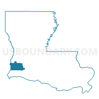
Outline

Summary
| Unique Area Identifier | 588273 |
| Name | Precinct 760 |
| County | Calcasieu Parish |
| State | Louisiana |
| Area (square miles) | 57.23 |
| Land Area (square miles) | 55.30 |
| Water Area (square miles) | 1.93 |
| % of Land Area | 96.63 |
| % of Water Area | 3.37 |
| Latitude of the Internal Point | 30.12635370 |
| Longtitude of the Internal Point | -93.67499280 |
Maps


Graphs
Select a template below for downloading or customizing gragh for Precinct 760, Calcasieu Parish, Louisiana


Neighbors
Neighoring Voting District (by Name) Neighboring Voting District on the Map
- Voting District 0001, Orange County, TX
- Voting District 0002, Orange County, TX
- Voting District 0003, Orange County, TX
- Voting District 0004, Orange County, TX
- Voting District 0006, Orange County, TX
- Precinct 1, Cameron Parish, LA
- Precinct 4, Cameron Parish, LA
- Precinct 561, Calcasieu Parish, LA
- Precinct 761, Calcasieu Parish, LA
Top 10 Neighboring County Subdivision (by Population) Neighboring County Subdivision on the Map
- Orange CCD, Orange County, TX (27,482)
- District 12, Calcasieu Parish, LA (13,429)
- District 11, Calcasieu Parish, LA (12,625)
- District 2, Cameron Parish, LA (1,262)
- District 1, Cameron Parish, LA (288)
Top 10 Neighboring Place (by Population) Neighboring Place on the Map
Top 10 Neighboring Unified School District (by Population) Neighboring Unified School District on the Map
- Calcasieu Parish School District, LA (192,768)
- Little Cypress-Mauriceville Consolidated Independent School District, TX (18,866)
- West Orange-Cove Consolidated Independent School District, TX (17,359)
- Cameron Parish School District, LA (6,839)
Top 10 Neighboring State Legislative District Lower Chamber (by Population) Neighboring State Legislative District Lower Chamber on the Map
- State House District 19, TX (139,948)
- State House District 22, TX (126,184)
- State House District 33, LA (45,884)
- State House District 47, LA (39,314)
Top 10 Neighboring State Legislative District Upper Chamber (by Population) Neighboring State Legislative District Upper Chamber on the Map
- State Senate District 4, TX (790,149)
- State Senate District 25, LA (117,807)
- State Senate District 30, LA (116,727)
Top 10 Neighboring 111th Congressional District (by Population) Neighboring 111th Congressional District on the Map
Top 10 Neighboring Census Tract (by Population) Neighboring Census Tract on the Map
- Census Tract 34, Calcasieu Parish, LA (4,619)
- Census Tract 36, Calcasieu Parish, LA (4,175)
- Census Tract 202, Orange County, TX (3,664)
- Census Tract 203, Orange County, TX (2,651)
- Census Tract 210, Orange County, TX (2,277)
- Census Tract 9702.01, Cameron Parish, LA (1,956)
Top 10 Neighboring 5-Digit ZIP Code Tabulation Area (by Population) Neighboring 5-Digit ZIP Code Tabulation Area on the Map
- 77630, TX (26,796)
- 77632, TX (22,776)
- 70665, LA (10,743)
- 70668, LA (6,424)
- 70661, LA (2,309)
- 70631, LA (962)